![](/images/other/stat-length.png)
![Excursión A pie Rothenburg ob der Tauber - Rothenburger W13 - Kirnberger Weg - Photo](https://media.geolcdn.com/t/1900/400/d569b6e8-20ae-4c7f-9f17-9f200af7a901.jpeg&format=pjpeg&maxdim=2)
Rothenburger W13 - Kirnberger Weg
SityTrail - itinéraires balisés pédestres
Tous les sentiers balisés d’Europe GUIDE+
![Longitud](/images/other/stat-length.png)
Longitud
8,2 km
![Altitud máxima](https://static1.geolcdn.com/siteimages/upload/files/1508320355ic_sort_altitude_max_24dp.png)
Altitud máxima
435 m
![Desnivel positivo](https://static1.geolcdn.com/siteimages/upload/files/1508320355ic_sort_den_pos_24dp.png)
Desnivel positivo
134 m
![Km-Effort](/images/other/stat-length.png)
Km-Effort
10 km
![Altitud mínima](https://static1.geolcdn.com/siteimages/upload/files/1508320355ic_sort_altitude_min_24dp.png)
Altitud mínima
359 m
![Desnivel negativo](https://static1.geolcdn.com/siteimages/upload/files/1508320355ic_sort_den_neg_24dp.png)
Desnivel negativo
139 m
![Boucle](https://static1.geolcdn.com/siteimages/upload/files/16400158638029165_repeat_loop_refresh_sync_direction_icon.png)
Boucle
No
Baliza
Fecha de creación :
2022-02-11 12:52:19.681
Última modificación :
2022-02-11 12:52:19.681
![A pie](https://static1.geolcdn.com/sitytour/trail-icons/100.png)
2h15
Dificultad : Fácil
![Escanee este código QR para abrir la excursión en la aplicación SityTrail](https://capi.geolives.com/qq0zvz2zws4bq2lad0pu/sitytour/trails/3088263/qr.png?size=200)
Aplicación GPS de excursión GRATIS
A propósito
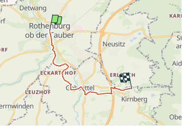
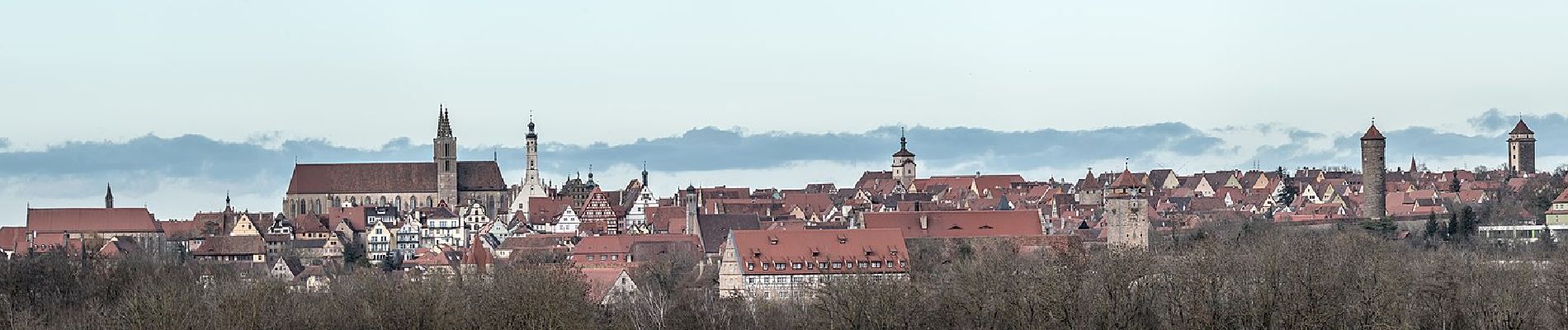
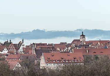
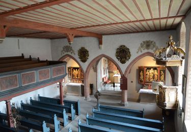
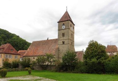
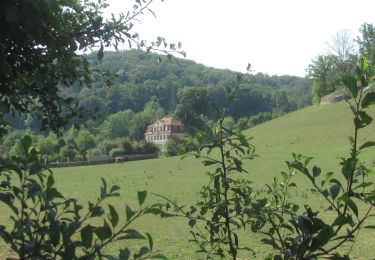
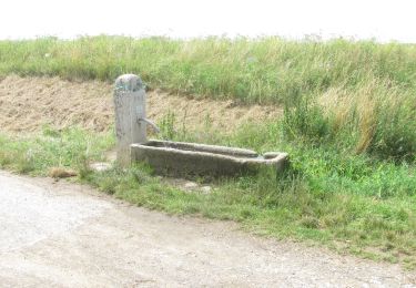
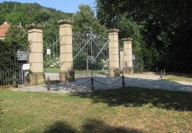
Ruta A pie de 8,2 km a descubrir en Baviera, Landkreis Ansbach, Rothenburg ob der Tauber. Esta ruta ha sido propuesta por SityTrail - itinéraires balisés pédestres.
Descripción
Trail created by Verkehrsverein Rothenburg ob der Tauber e.V..
Symbol: Weiße 13, 13a und 13b auf rotem Schild
Localización
País:
Germany
Región :
Baviera
Departamento/provincia :
Landkreis Ansbach
Municipio :
Rothenburg ob der Tauber
Localidad:
Unknown
Salida:(Dec)
Salida:(UTM)
585602 ; 5470021 (32U) N.
Comentarios
Excursiones cerca
![Excursión A pie Rothenburg ob der Tauber - Rothenburger W4 - Natursteig - Photo](https://media.geolcdn.com/t/375/260/d569b6e8-20ae-4c7f-9f17-9f200af7a901.jpeg&format=jpg&maxdim=2)
![A pie A pie](https://static1.geolcdn.com/sitytour/trail-icons/100.png)
Rothenburger W4 - Natursteig
A pie
Fácil
Rothenburg ob der Tauber,
Baviera,
Landkreis Ansbach,
Germany
![](/images/other/stat-length.png)
6,8 km | 8,4 km-effort
1h 54min
![](https://static1.geolcdn.com/siteimages/upload/files/16400158638029165_repeat_loop_refresh_sync_direction_icon.png)
No
![Excursión A pie Rothenburg ob der Tauber - Rothenburger W3 - Kleiner Taubertalweg - Photo](https://media.geolcdn.com/t/375/260/2d219dd4-d118-4615-825c-f1e0ab382514.jpeg&format=jpg&maxdim=2)
![A pie A pie](https://static1.geolcdn.com/sitytour/trail-icons/100.png)
Rothenburger W3 - Kleiner Taubertalweg
A pie
Fácil
Rothenburg ob der Tauber,
Baviera,
Landkreis Ansbach,
Germany
![](/images/other/stat-length.png)
4 km | 5,6 km-effort
1h 16min
![](https://static1.geolcdn.com/siteimages/upload/files/16400158638029165_repeat_loop_refresh_sync_direction_icon.png)
Sí
![Excursión A pie Rothenburg ob der Tauber - Rothenburger W1 - Detwanger Weg - Photo](https://media.geolcdn.com/t/375/260/3855134a-1211-4ce0-bb69-11a7db59eccd.jpeg&format=jpg&maxdim=2)
![A pie A pie](https://static1.geolcdn.com/sitytour/trail-icons/100.png)
Rothenburger W1 - Detwanger Weg
A pie
Fácil
Rothenburg ob der Tauber,
Baviera,
Landkreis Ansbach,
Germany
![](/images/other/stat-length.png)
3,5 km | 4,8 km-effort
1h 6min
![](https://static1.geolcdn.com/siteimages/upload/files/16400158638029165_repeat_loop_refresh_sync_direction_icon.png)
Sí
![Excursión A pie Rothenburg ob der Tauber - Rothenburger W2 - Zu den Rothenburger Mühlen - Photo](https://media.geolcdn.com/t/375/260/fd08601b-fa2a-4d50-9433-292f77fe7f6e.jpeg&format=jpg&maxdim=2)
![A pie A pie](https://static1.geolcdn.com/sitytour/trail-icons/100.png)
Rothenburger W2 - Zu den Rothenburger Mühlen
A pie
Fácil
Rothenburg ob der Tauber,
Baviera,
Landkreis Ansbach,
Germany
![](/images/other/stat-length.png)
10,7 km | 13,3 km-effort
3h 1min
![](https://static1.geolcdn.com/siteimages/upload/files/16400158638029165_repeat_loop_refresh_sync_direction_icon.png)
Sí
![Excursión A pie Rothenburg ob der Tauber - DE-NW blau - Photo](https://media.geolcdn.com/t/375/260/fd08601b-fa2a-4d50-9433-292f77fe7f6e.jpeg&format=jpg&maxdim=2)
![A pie A pie](https://static1.geolcdn.com/sitytour/trail-icons/100.png)
DE-NW blau
A pie
Fácil
Rothenburg ob der Tauber,
Baviera,
Landkreis Ansbach,
Germany
![](/images/other/stat-length.png)
3,2 km | 3,9 km-effort
53min
![](https://static1.geolcdn.com/siteimages/upload/files/16400158638029165_repeat_loop_refresh_sync_direction_icon.png)
Sí
![Excursión A pie Rothenburg ob der Tauber - DE-NW rot - Photo](https://media.geolcdn.com/t/375/260/ad83b47e-3323-4ea1-8fe2-a79eaf813dd4.jpeg&format=jpg&maxdim=2)
![A pie A pie](https://static1.geolcdn.com/sitytour/trail-icons/100.png)
DE-NW rot
A pie
Fácil
Rothenburg ob der Tauber,
Baviera,
Landkreis Ansbach,
Germany
![](/images/other/stat-length.png)
7,7 km | 9,7 km-effort
2h 12min
![](https://static1.geolcdn.com/siteimages/upload/files/16400158638029165_repeat_loop_refresh_sync_direction_icon.png)
Sí
![Excursión A pie Neusitz - Rothenburger W11 - Lug ins Land - Photo](https://media.geolcdn.com/t/375/260/1193c70e-1492-40c9-a8f0-1f45d7068679.jpeg&format=jpg&maxdim=2)
![A pie A pie](https://static1.geolcdn.com/sitytour/trail-icons/100.png)
Rothenburger W11 - Lug ins Land
A pie
Fácil
Neusitz,
Baviera,
Landkreis Ansbach,
Germany
![](/images/other/stat-length.png)
5,7 km | 6,8 km-effort
1h 32min
![](https://static1.geolcdn.com/siteimages/upload/files/16400158638029165_repeat_loop_refresh_sync_direction_icon.png)
No
![Excursión A pie Rothenburg ob der Tauber - Rothenburger W10 - Lindleinsee - Photo](https://media.geolcdn.com/t/375/260/1193c70e-1492-40c9-a8f0-1f45d7068679.jpeg&format=jpg&maxdim=2)
![A pie A pie](https://static1.geolcdn.com/sitytour/trail-icons/100.png)
Rothenburger W10 - Lindleinsee
A pie
Fácil
Rothenburg ob der Tauber,
Baviera,
Landkreis Ansbach,
Germany
![](/images/other/stat-length.png)
6,5 km | 7,4 km-effort
1h 40min
![](https://static1.geolcdn.com/siteimages/upload/files/16400158638029165_repeat_loop_refresh_sync_direction_icon.png)
No
![Excursión A pie Rothenburg ob der Tauber - Rothenburger W9 - Bettwar - Photo](https://media.geolcdn.com/t/375/260/a5789f1d-48b7-4b9b-bea2-01de53df7d3e.jpeg&format=jpg&maxdim=2)
![A pie A pie](https://static1.geolcdn.com/sitytour/trail-icons/100.png)
Rothenburger W9 - Bettwar
A pie
Fácil
Rothenburg ob der Tauber,
Baviera,
Landkreis Ansbach,
Germany
![](/images/other/stat-length.png)
6 km | 7,6 km-effort
1h 43min
![](https://static1.geolcdn.com/siteimages/upload/files/16400158638029165_repeat_loop_refresh_sync_direction_icon.png)
No